

The Map - world maps, offline
The Map gives you offline maps of entire countries (including the USA, Canada and Great Britain). This is ideal as a secondary map source, for such activities as walking and cycling (supports GPX files), where cell towers are a bit hard to find.
Please note a few things before continuing:
● If youre looking for a primary map source, this probably isnt it. The map data is derived from OpenStreetMap. If a map feature isnt on OpenStreetMap, it wont be available in The Map.
● In order to fit that whole of a country on your device, some map features have to be omitted. For example house numbers are not visible.
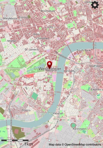
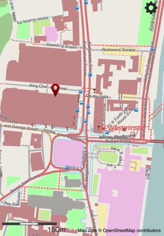
● All maps are rendered on your device. Because of this, the maps are best view quite close in, but NOT when zoomed far out.
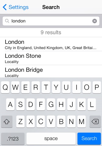
● Search is only available in the native language of the location. For example, you can only locate the capital of Japan its name in Japanese: 東京.
The Map takes advantage of the Retina display on both the new iPad and iPhones to any map detail look razor sharp.
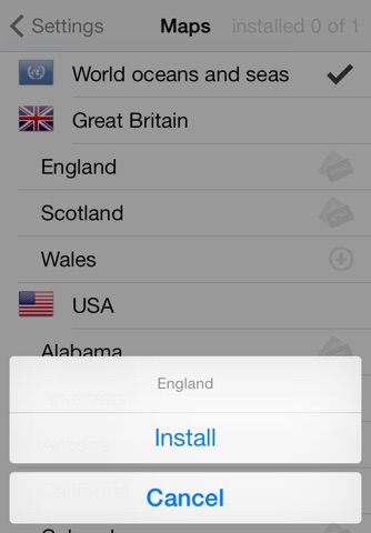
The countries currently available are:
● Albania, Andorra, Australia, Austria
● Belarus, Belgium, Bosnia and Herzegovina, Bulgaria
● Canada, China, Croatia, Cyprus, Czech Republic
● Denmark
● Estonia
● Faroe Islands, Finland, France
● Germany, Great Britain (England, Scotland and Wales), Greece
● Hungary
● Iceland, Ireland, Italy
● Japan
● Latvia, Liechtenstein, Lithuania, Luxembourg
● Macedonia, Malta, Moldova, Monaco, Montenegro
● Netherlands, New Zealand, Norway
● Philippines, Poland, Portugal
● Romania
● Serbia, Singapore, Slovakia, Slovenia, Spain, Sweden, Switzerland
● Tunisia, Turkey
● USA (continental United States and Hawaii, Alaska coming soon), Ukraine
Other countries will become available over time, although specific requests will be processed sooner.
The Map allows you to:
● Access maps offline for entire countries without connecting to any network. This even works in airplane mode.
● Quickly access maps as all the data is on your device - no need to use the slow cellular network²
● Search for any place name - this works for villages, towns and cities (and for postcodes in Great Britain too).
● Use the in built GPS of the iPhone or iPad 3G to track your own position on the map³.
● Support for importing GPX traces from other apps including Email, Safari and iTunes.
¹ The data is obtained from Geofabrik, who chop up OpenStreetMaps data into distinct countries. Each map is pretty big (currently they vary between 25MB and 2100MB), so to avoid using up your data allowance, they can only be downloaded over Wi-Fi (not 3G).
² When the application starts for the first time, all the data for the first country you choose is downloaded. After that, the application never needs the network (unless you download another map).
³ This feature is limited on the iPod Touch and iPad WiFi, due to hardware constraints.